New Mexico is a fabulous mix of ranches, deserts, and mountains. Many RVers travelling to the Grand Canyon will pass over I-40, and if they are heading to Southern Arizona may cut across sw on Route 60 from Vaughn to Mountainair and on into the Valley of the Rio Grande. Route 60 passes over the high plains at 1900m. it may not look like good ranch country but cattle do well on the nutritious growth they find, no matter how scarce it is. Irrigation produces a few circular fields for hay.
Mountains block the skyline in several directions as you drive through, and sometimes there are colourful buttes, and mesas.
Water was not so scarce a few hundred years ago and as a result much of the country around Mountainair was sustaining ancient settlements of early indigenous people and Abo was visited by the Spanish who interfered with the lives of the natives by sending missionaries. Abo was the head of a large missionary centre and is now part of the National Monument Salinas Missions with three archaeological sites the modern traveller can visit.

In fact, there were periods where rain was abundant enough to grow crops in the last century. If you look at Google Earth you will see hundreds of acres which are now brown rectangles. Here they grew tons of beans, and shipped out train loads of them. Then about 1946 a long drought brought an end to it, and farmers left. This is just another example of normal weather changes found on earth.
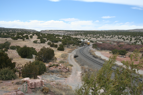
West of Mountainair you drop down from the high plateau to a wide flatter Rio Grande Valley. The water from the plateau eroded the deep Abo Canyon carving a sinuous channel and created a fairly gentle grade. This looked very good to the old ATSF (Atkinson, Topeka, and Santa Fe Railroad company) who were looking for an easier route to get out of the Rio Grande Valley than the Raton Pass and Glorietta Pass, both being quite steep. The gradient in Abo Canyon would be 30% less.

In 1906 they began building a single line track with several bridges across the meandering river, and established quarters at Belen to the west and Mountainair to the east. In between you can find the ghost towns of Scholle and Abo.
As the years rolled along rail traffic increased until it wasn’t unusual to have 70 trains per day. For several years steam engines often hooked onto diesel locomotives to help them make the grade. Tracks on either side of Abo Canyon were doubled but trains had to park on sidings to let others use the single tracked canyon.
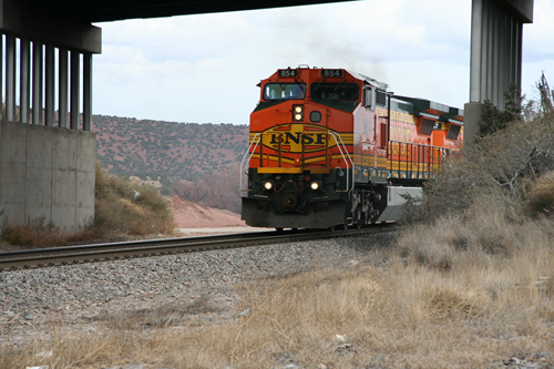
In 1996, the Burlington Northern Railroad joined with the ATSF creating the Burlington Northern and Santa Fe, BNSF. By 2000, with a train every 25 minutes the single tracked canyon was a huge bottleneck with many trains delayed, waiting for their turn, often up to an hour.
In the 1990’s planning began for double tracking, with construction beginning in 2008. The problem was the original canyon was too narrow for two tracks. They had to be careful not to damage any archaeological sites, and some were concerned with damage to the environment. With thousands of square miles of partially bare earth and rock with scrub evergreens, one would wonder how it could look any worse but judicious care and clean-up has left the canyon intact and the two lines are now carrying the more than 100 trains per day without any problems and no backed up traffic.
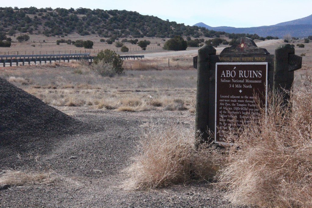
You can stop at the rest area, or what is left of it to get pictures of the track and trains. The highway department allowed the piling of old asphalt not only in the rest area, but also hiding the historic sign that tells about the area. Maybe it will be cleaned up when you get there, but I’ve passed by there several years in a row, and it’s been a mess each time.

Recent Comments